
GIS and Spatial Analysis (Minor)
Spatial analysis and geographic information systems is a mouthful of words, and most people simply refer to the entire field more loosely as GIS or sometimes GIScience. The modern world runs on data, and much of that data is best organized and analyzed by placing it on a two- or even three-dimensional map.
- Degrees & Offerings
-
- Minor
- Location
-
- Bloomsburg
- Lock Haven
- Mansfield
- Program Contact
-
Associate Professor of Environmental, Geographical, and Geological Sciences
This is what we mean by GIS.
It’s a technical field.
Government, military, commercial and other interests rely on information about the land and the location and characteristics of people and resources. For centuries, maps have served as the primary mechanism for managing, analyzing and communicating geospatial information.
With the advent of the computer, geospatial technologies, and digital data this process evolved considerably and moved into the digital age. This minor introduces you to geographic information systems (GIS), particularly the technologies and mapping/analysis techniques that will compliment your current intended major.
Courses and Curriculum
Commonwealth Because
Licensure and Certification
There are many certifications that can set you apart from the herd. Perhaps the first to consider is the ESRI ArcGIS Desktop Entry level exam. After completing the minor program, you will have a solid foundation in the concepts and skills you will need to prepare for this first step.
The Commonwealth Difference
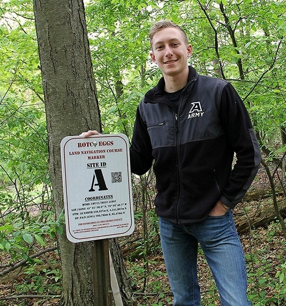
GIS Students Develop Orienteering Course
ROTC cadet Nicholas Correll had an idea one day while sitting in his geographic information system (GIS) class. Instead of driving 30 minutes for ROTC land navigation trainings, why not just create an orienteering course on upper campus?

Data Mining Helps with Florida Forest Conservation
A remote sensing geography class from CU - Bloomsburg played a key role in the conservation of a 14-acre southern Florida forest home to protected wildlife that’s been fending off urban and commercial development for the past 60 years.
Applying to This Program
Apply
-
Application Process
Review the step-by-step process whether you're a first-year student, transferring to CU, or more.
-
Apply Now
By starting your application, you gain access to your personalized application portal to view your progress.
-
Scholarships
As the largest comprehensive university in north central and northeastern Pennsylvania, CommonwealthU works hard to provide a world-class education that consistently rates among the best values in the nation.
Explore More
-
Explore Commonwealth University
There's no better way to learn more than to experience Commonwealth University for yourself! Set up a campus tour or connect with us virtually.
-
Connect with Your Admissions Counselor
Applying to college is a big step. You have questions, and we have answers!
-
Understanding Financial Aid
Financial Aid can be a complex topic. Our Financial Aid team is here to tell you what you need to know and help you navigate the financial aid process.
